


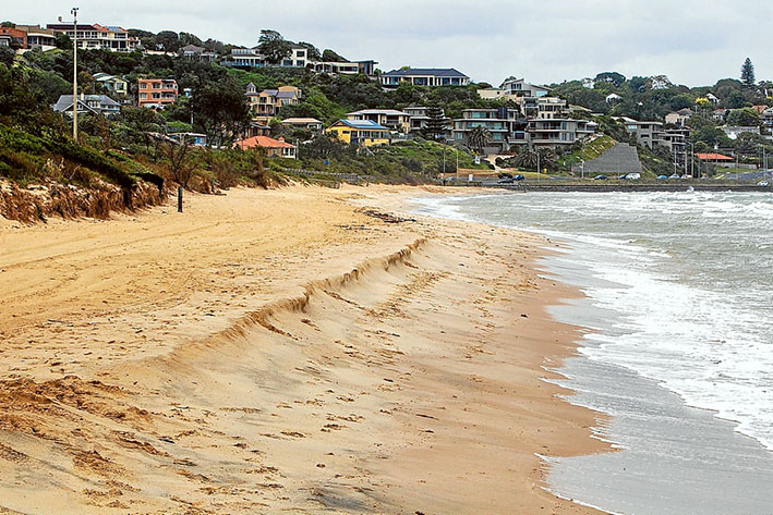
EROSION is expected to put coastal areas in Frankston and Mordialloc at risk by 2040, according to a Victorian Environmental Assessment Council report.
The report, released last month, states that the Port Phillip Bay from Seaford to Mordialloc is among the “areas most vulnerable to inundation by 2040 with a 20 centimetre sea level rise from a baseline set in 2009.”
Climate change factors such as “reductions in winter and spring rainfall combined with an increase in downpour intensity and frequency, warmer temperatures with an increase in mean air temperature, and increased wind speeds” are listed in the VEAC report as having an impact.
The report reads that “increasing sea levels and storm intensities will intensify coastal hazards such as coastal flooding, storm erosion and long-term shoreline recession. Sea level rise will lead to more frequent inundation of low lying areas, loss of coastal habitat, cliff, beach and foreshore erosion.”
“Due to changes in wave and wind direction, there may be a realignment of the coastline in some areas. The predictions indicate the intensity of storms is likely to increase, leading to greater erosion. Less is known about the likely changes to wind direction and corresponding wave direction. However, if changes do occur this will lead to coastal realignment,” it is stated in the report.
The VEAC report also identified Mordialloc and Kananook creeks as being at risk of being affected by “toxicants such as metals and organochlorine pesticides”, with increased levels being found in those two bodies of water.
The VEAC Assessment of the Values of Victoria’s Marine Environment report was submitted to the state’s energy, environment, and climate change minister Lily D’Ambrosio on 21 May. The minister requested an assessment in March 2018.
The VEAC stated that the purpose of the report was to “identify current environmental, economic, social and cultural values of Victoria’s marine environment, including their spatial distribution where relevant, identify current and likely future threats to these values, provide independent advice on future patterns, trends and direction related to existing and emerging uses, determine a process to systematically classify data and an approach to describe social economic values and uses of Victoria’s marine waters” and “provide an inventory of available knowledge and data on existing values, uses and threats and advise on any significant gaps.”
First published in the Chelsea Mordialloc Mentone News 26 June 2019


