

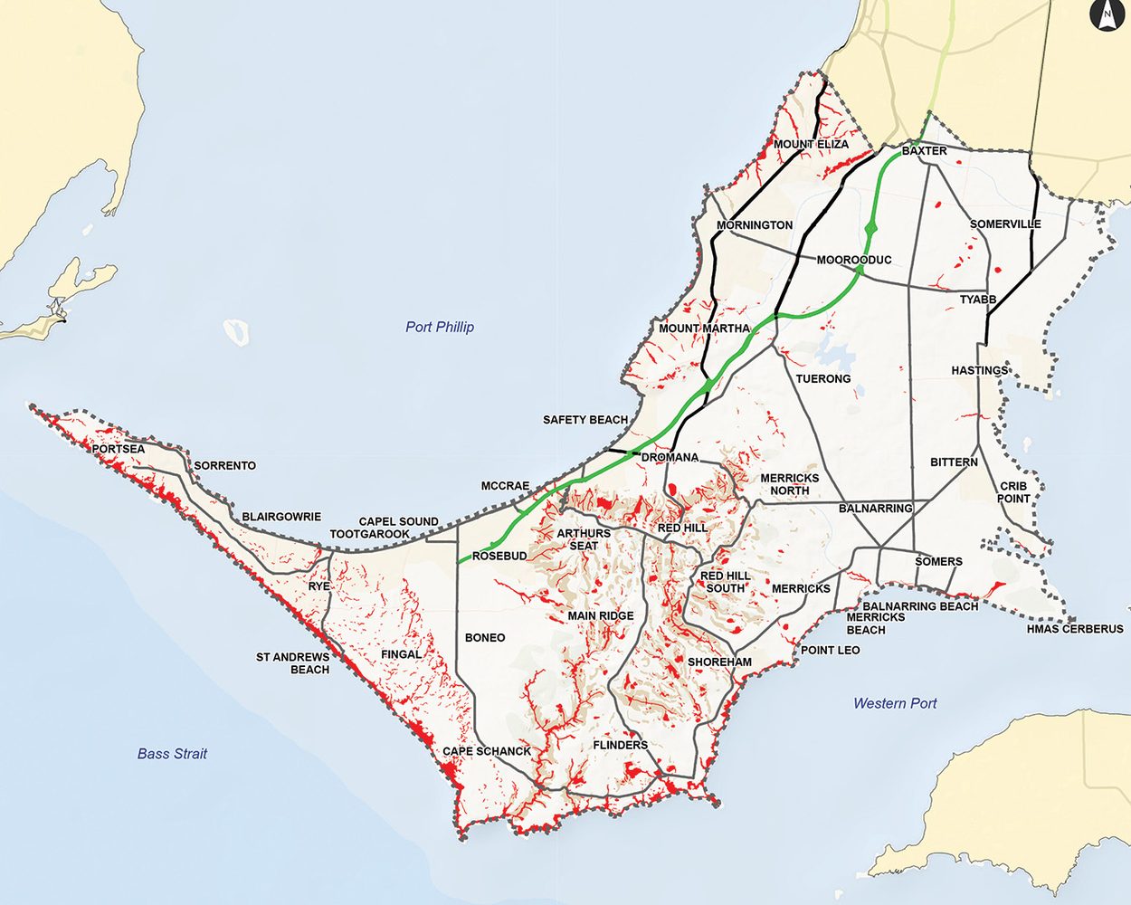
THOUSANDS of properties will be removed from the interim Erosion Management Overlay (EMO7) after the state government approved a planning scheme amendment.
The approval of Planning Scheme Amendment C314morn means the number of properties covered by the overlay will be reduced from around 33,000 to 6,000.
The amendment ensures planning controls are targeted to areas of landslide susceptibility and will make planning requirements simpler for landowners undertaking minor buildings and works.
Mayor Cr Stephen Batty said the changes delivered a fairer and more targeted approach while continuing to manage landslide risk responsibly.
“Council understands the frustration experienced by many property owners when the interim overlay was initially introduced earlier this year, and we’re pleased the updated mapping will significantly reduce the number of properties affected,” said Batty.
The EMO7 was introduced by the Planning Minister in January of 2026 following urgent recommendations from the McCrae landslide board of inquiry (“Minister approves interim landslide overlay despite errors”, The Times, 12/01/26).
In August, the shire decided to request amendments to the overlay after an updated review using expert advice (“Shire to seek changes to landslide overlay”, The Times, 10/08/26).
“We acted quickly to review the mapping, working with geotechnical experts to use better data and technology to more accurately identify areas of landslide susceptibility,” said Batty.
The revised EMO7 follows a review of existing landslide susceptibility mapping by geotechnical experts and uses improved data and technology to better identify areas prone to landslides.
The revised overlay will apply to about 4,200 residential and 1,800 non-residential properties, which cover about five per cent of the peninsula’s total land area.
Around 40 per cent of the land within the updated overlay is public land.
A small number of properties will be added to the overlay, many of which are adjacent to slopes where the refined mapping introduces a buffer zone to help manage the potential for new development to increase landslide risk.
Batty said the updated overlay would remain an interim measure while the council prepares a comprehensive new shire-wide landslide susceptibility study to develop and apply permanent controls to replace the EMO7.
This will take around two to four years to complete, including community consultation and a full planning scheme amendment process.
“While an Erosion Management Overlay would not have prevented the McCrae landslide, council accepted the Minister’s decision to urgently implement the board of inquiry’s recommendation,” said Batty.
“This amendment is an important step in improving the way landslide susceptibility is identified and managed while longer-term work continues.”
More information is available at: mornpen.vic.gov.au/C314morn.
First published in the Frankston Times – 27 October 2026